The Derwentwater Walk
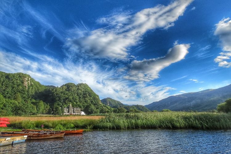
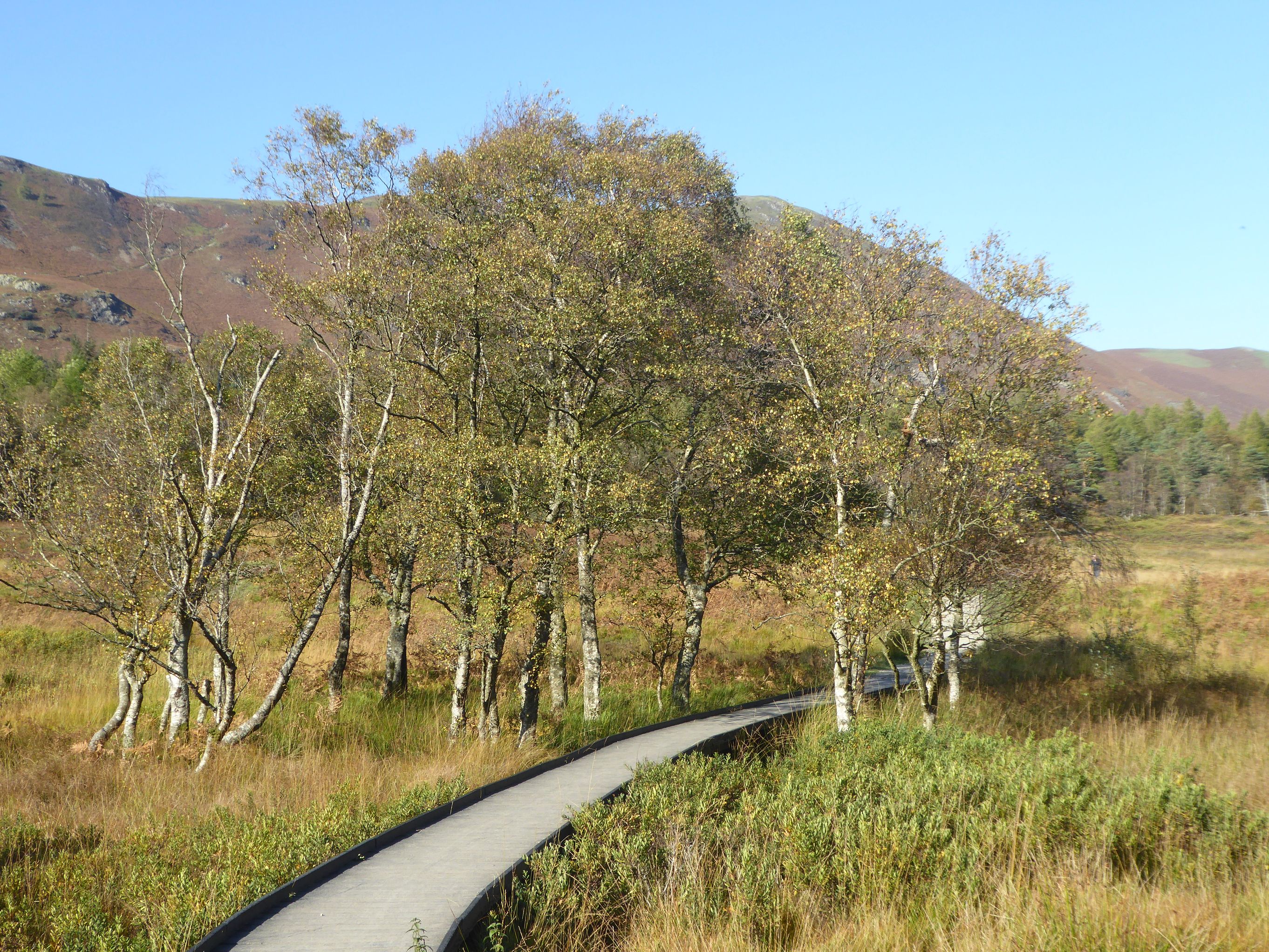
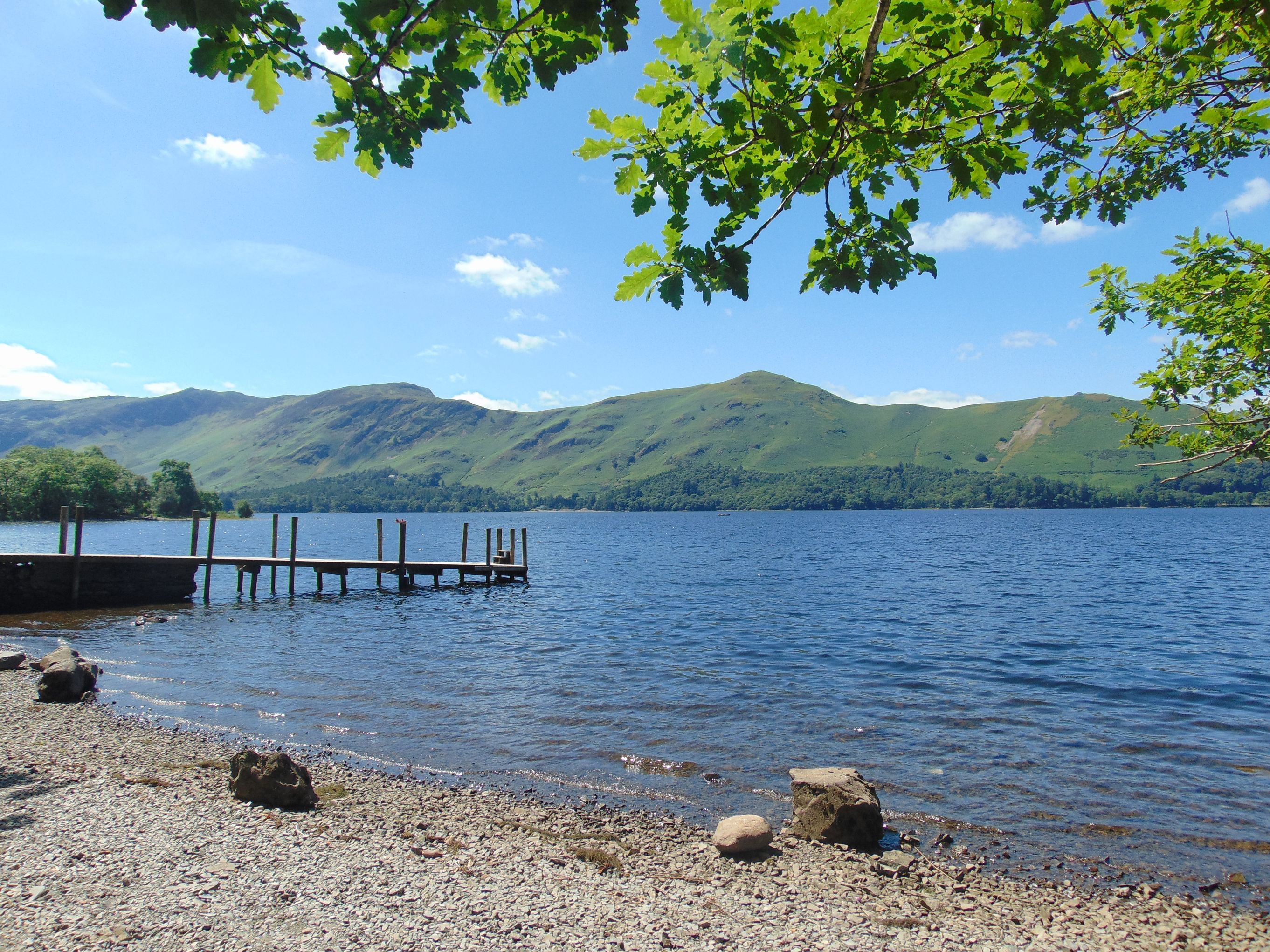
The Derwentwater Walk is a waymarked path which will take you on a 10 mile scenic walk around Derwentwater, Queen of the Lakes. On flat and easy paths, the walk passes through ancient woodlands and along the shores of the lake. The scenery is stunning, with perfect picnic stops and cafés and restaurants en-route.
Derwentwater is 5km (3 miles) long; 6km (I mile) at its widest point and 22m (72 feet) at its deepest. It has a particularly rich and varied flora and wildlife, much of which is cared for by the National Trust.

- Distance - 10 miles
- Time - Take a whole day out to enjoy this walk at a leisurely pace. It can also be enjoyed as shorter walks by taking a bus or catching a launch from one of the landing stages.
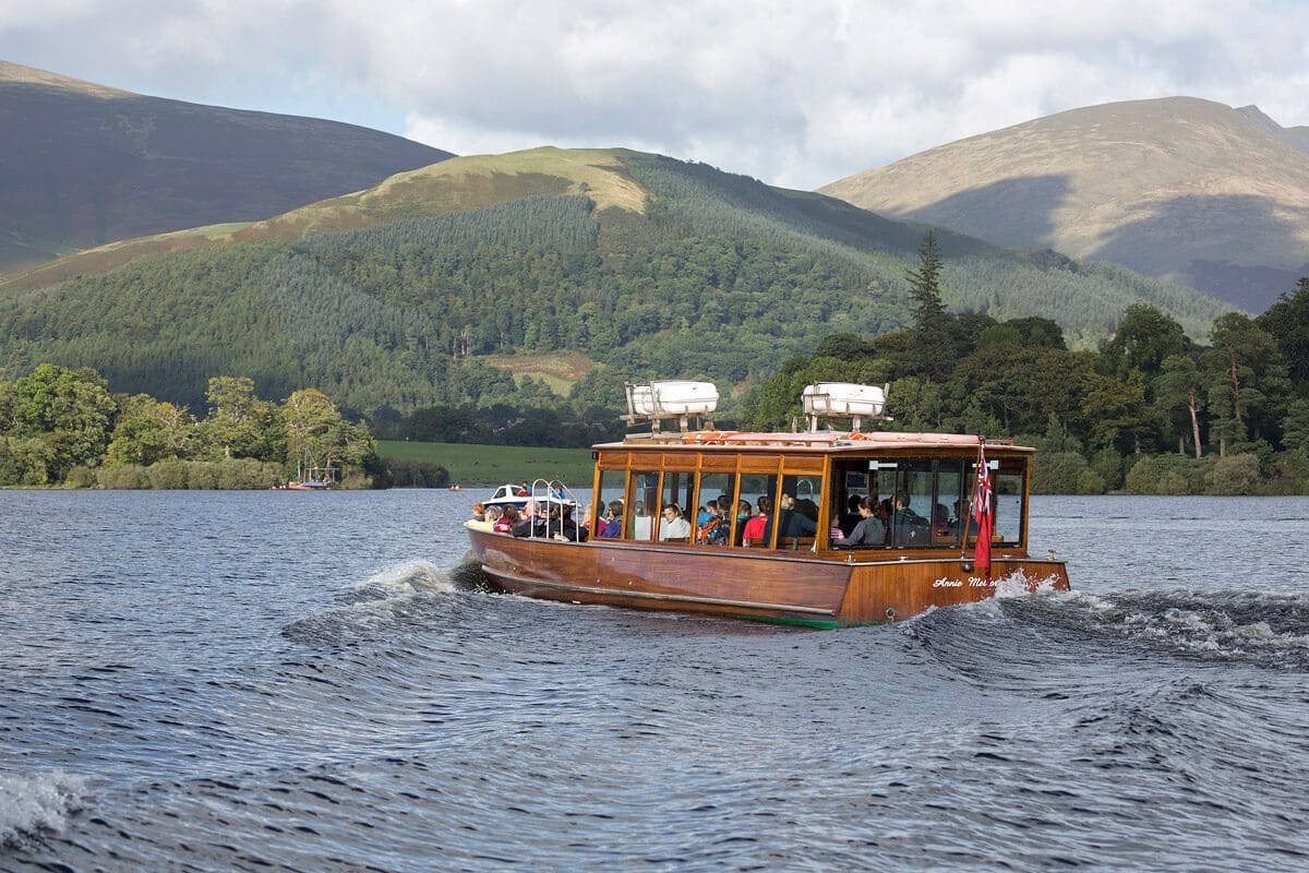
- Starting point - By the lakeshore at the Keswick Launch.
- Parking - various car parks in Keswick
- Notes - On flat and easy paths, the walk passes through ancient woodlands and along the shores of the lake.
- Feedback - Contact Keswick Tourism Association by email [email protected]

1. Your walk starts by heading out from the National Trust Shop and Information Point past the jetties and continuing on a gravel track beside the lake towards Friar’s Crag. On your right is the first of four principal islands on Derwentwater - Derwent Island.
2. Take the right fork to reach the viewpoint of Friar’s Crag.
3. With the lake still on your right continue down some steps to rejoin the waymarked path, through a gate to follow a shoreline path. Soon enter woodland again through a gate. This is the Ings.
4. At the exit to the wood turn right along a wide track. Cross a cattle grid into a field and follow the path round the field past Stable Hills Cottages to the lake.
5. Pass through a gate and continue into a small woodland. Take time to sit on the Millennium Seat on the headland enjoying the view up the lake towards the Jaws of Borrowdale. Now follow the path down to reach Calfclose Bay. Look out for the Hundred Year Stone on the shoreline. The wood above you on your left is Great Wood. On another day why not enjoy the Great Wood walk from here.
6. Continue along the lakeshore round the bay until you pass through a stand of Scots Pines and reach a wooden footbridge over a ghyll.
7. If the lake level is low enough you may be able to continue along the stony lake shore from here to Ashness Gate. Otherwise follow the path left beside the ghyll to a stile in the wall and turn right along the roadside footpath until you reach the Ashness Gate landing stage and a bus stop.
8. From the jetty follow the path along the shore and round the promontory. As you reach the road again walk along the top of the stone walkway below the road to reach Kettlewell car park.
9. Cross the road here with care and turn right onto a rocky footpath which winds through the woodland separated from the road by a stone wall. When you see the Lodore Falls Hotel ahead follow the path down to the road.
10. Turn left into the road. Cross the road and proceed in front of the Lodore Falls Hotel taking care where there is no footpath. After the hotel re-join the roadside path. Continue for 200m to a gate and stile on your right leading to a broad track signposted to Manesty.
11. Follow this down to the River Derwent where a single span footbridge arches over the river. This is known locally as the Chinese Bridge.
Diversion If the lake level is high and the board walk beyond the bridge is under water you may have to continue along the road to Grange where you can cross on the road bridge. Continue along the road until you reach a waymarked track on your right which will lead you back to the lakeshore beyond the boardwalks (about 3km total diversion, see map).
12. Having crossed the bridge you will find yourself on a boardwalk raised above the marshy meadows. Through the gate at the far end of the board walk continue along the gravelly path with the lake to your right crossing further short stretches of boardwalk.
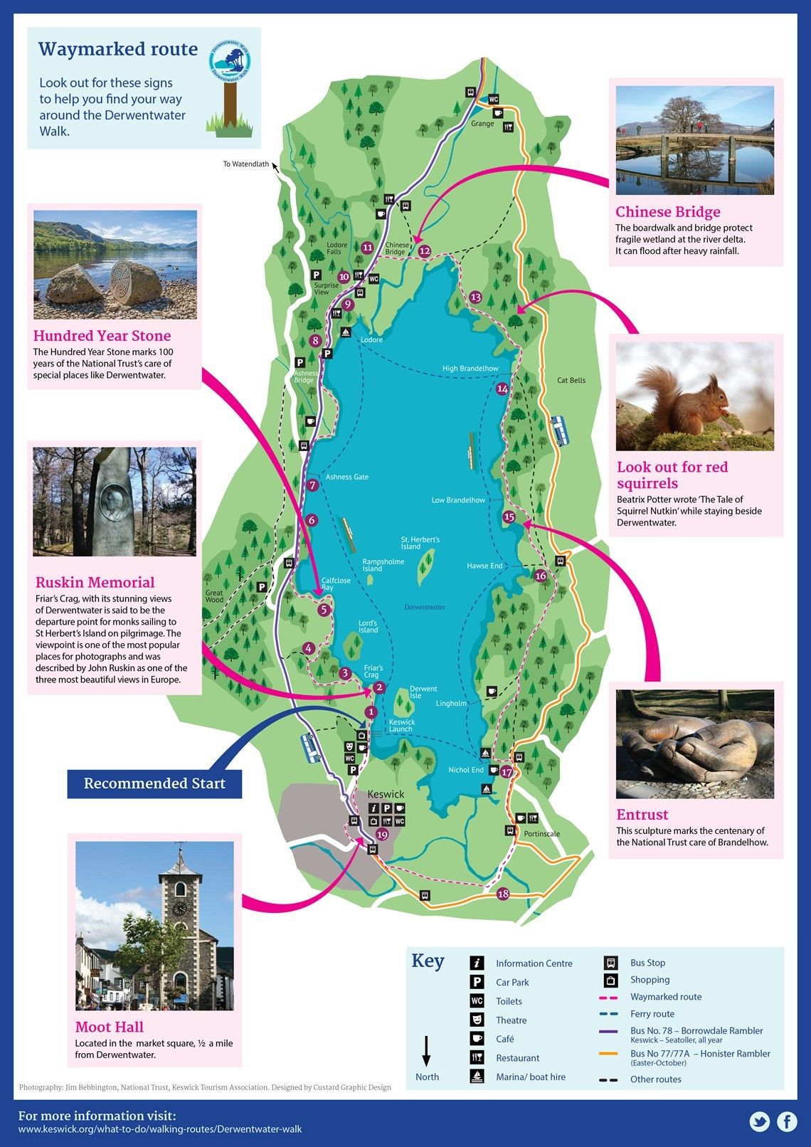
13.Enter woodland through a gate and continue with intermittent views of the lake through the trees until you reach a drive. Turn right and continue along a track bearing left to a kissing gate. The path bears right through some old mine workings (Brandelhow Bay). Either follow the path bearing left up the hill to a gate on your right into woodland or keep to the shoreline round the base of the heap of mine waste. Both routes lead to High Brandelhow landing stage.
14. Continue on the shoreline path through the woodlands of Brandelhow Park. Follow the lakeshore path to arrive at Low Brandelhow landing stage. Look out for the Hands Sculpture en-route. From here you can catch the launch back to Keswick if you want to shorten your walk.
15. Continue through the gate by the jetty and take the path that bears left away from the lake. After going through another gate the track bears right and continues to reach a tarmac drive. Turn right here and continue past Hawse End Outdoor Centre. To use the launch from Hawse End take the first path to the right signposted to Hawse End Jetty.
16. To continue walking to Keswick take the second path on your right just past the private drive to Derwent Bay. Descend through woodland and cross a field to reach more woodland. Emerge from this through a gate. Cross a road and go ahead on a waymarked track. Cross a drive and descend the path to Nichol End Marine and landing stage.
17. Turn left and walk along the track to reach the road to Portinscale. Turn right and walk along the pavement through the village of Portinscale (take care when the pavement ends). Turn right at the first major junction (waymarked). Continue along the road past the Derwentwater Hotel to cross the suspension bridge over the River Derwent.
18. Continue along the road for 100 metres and turn right on a footpath between fields. At the main road, cross the bridge right over the River Greta. Continue along the road to reach the mini roundabout and straight on into the Market Square.
19. If you want to return to your starting point stroll up the Market Square past the Moot Hall and take the right hand exit out of the Market Square (Lake Road). Continue for about 150 metres and then take the paved street (still Lake Road) on your right by George Fisher store. At the bottom of the hill bear left through the subway and then turn left and follow the pavement round to your starting point, passing through Hope Park Gardens en route.
Downoad pdf of the Derwentwater Walk and Map
Have you found this walking route useful and would like to make a donation? All our walks are provided free of charge to download but you might consider donating a small one-off amount to help with the running costs and upgrades to our website. This website is run by Keswick Tourism Association, a not for profit trade organisation, which is funded almost totally by its members.