The Newlands Round
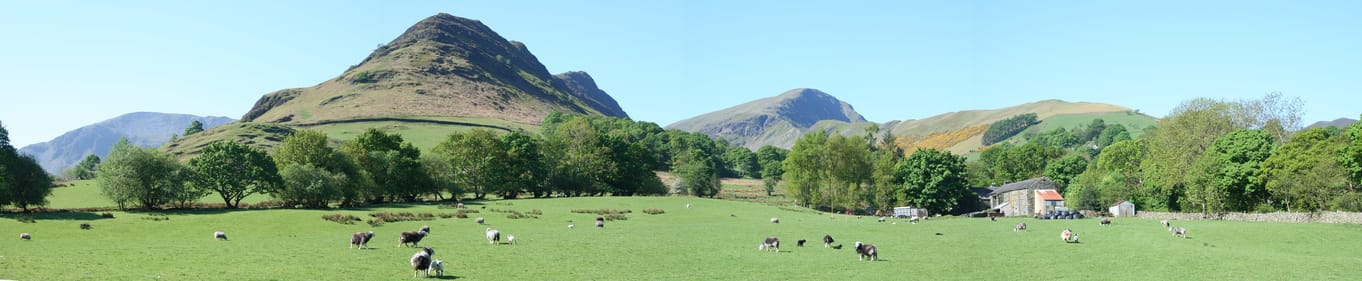
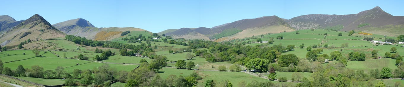
The Newlands Valley nestles within the fells on the western side of Derwentwater. Only a stones throw from Keswick it encompasses an amazing array of mountain scenery. Its upper reaches are as wild as any British hills, whilst its mouth is a classic patchwork of fields, walls, trees and hamlets.
This walk tackles the skyline crest and exploits the line of least resistance to reach a significant number of summits. It crosses the famous trio of Cat Bells, Maiden Moor and High Spy then turns west to cross the more remote summits of Dale Head and Robinson.
Distance and height gain are modest for this type of ‘horseshoe’ but it’s a full day out and a map and compass should be taken.
- Start/Finish: Little Town, near Keswick (GR NY 233 194)
- Distance: 8 miles (13km)
- Time: 5-6 hours
- Height gain: 923m
- Terrain: Steep sided valley, packhorse track, narrow col, broad ridge, moorland shoulder, steep slope, grassy summit ridge.
- Maps: OS Landranger 90, OS Explorer OL 4; Harveys’ Superwalker (1:25 000 Lakeland West); British Mountain Maps Lake District (1:40 000).
1. From car park head northwest up the road to Hause Gate bridleway on the right. This ancient packhorse routes climbs steadily to gain the notch on the ridge between Cat Bells and Maiden Moor.
2. Although not on main horseshoe Cat Bells is reached by making a short out and back walk north along the main crest.
3. Maiden Moor is the first real summit on main horseshoe. From Hause Gate follow the main crest south; it’s fairly steep but eases to give a pleasant climb with wide ranging views.
4. The next leg to High Spy involves only a little height gain and is a real delight along an elevated crest with good views on both sides.
5. From High Spy a gentle descent leads to a scooped out shoulder on the eastern side of Dale Head. Scattered across the shoulder are Dalehead Tarn, Launchy Tarn and High Scawdale Tarn. Dalehead Tarn is the largest and its surrounding rocks make a sheltered place for lunch!
6. The path descending north from the shoulder beside Newlands Beck is a shortcut back to Little Town if time is short.
7. From the shoulder the ascent to the summit of Dale Head is the hardest of the day but it’s the highest peak of the round and a fantastic viewpoint. To the north; the upper Newlands Valley and to the west is Buttermere, Crummock Water and Loweswater.
8. Head west along Hindscarth Edge; a fairly narrow crest with lofty drops on both sides, take care. At its western end Hindscarth Edge merges into a raised dome with two ridges splitting off. Follow the northern ridge to the summit of Hindscarth.
9. The path off Hindscarth is reasonably obvious, but in poor visibility check on a compass; it’s easily confused with the subsidiary ridge leading to precipitous craggy ground of Squat Knotts.
10. Above High Crags the path swings northeast and drops down the steepening, stepped crest of Scope End. Towards the foot of ridge turn sharp right, follow path to the farm at Low Snab. Follow track to the church, turn right along the lane to join road back to Little Town.
Download pdf - Newlands Round walking route
Have you found this walking route useful and would like to make a donation? All our walks are provided free of charge to download but you might consider donating a small one-off amount to help with the running costs and upgrades to our website. This website is run by Keswick Tourism Association, a not for profit trade organisation, which is funded almost totally by its members.