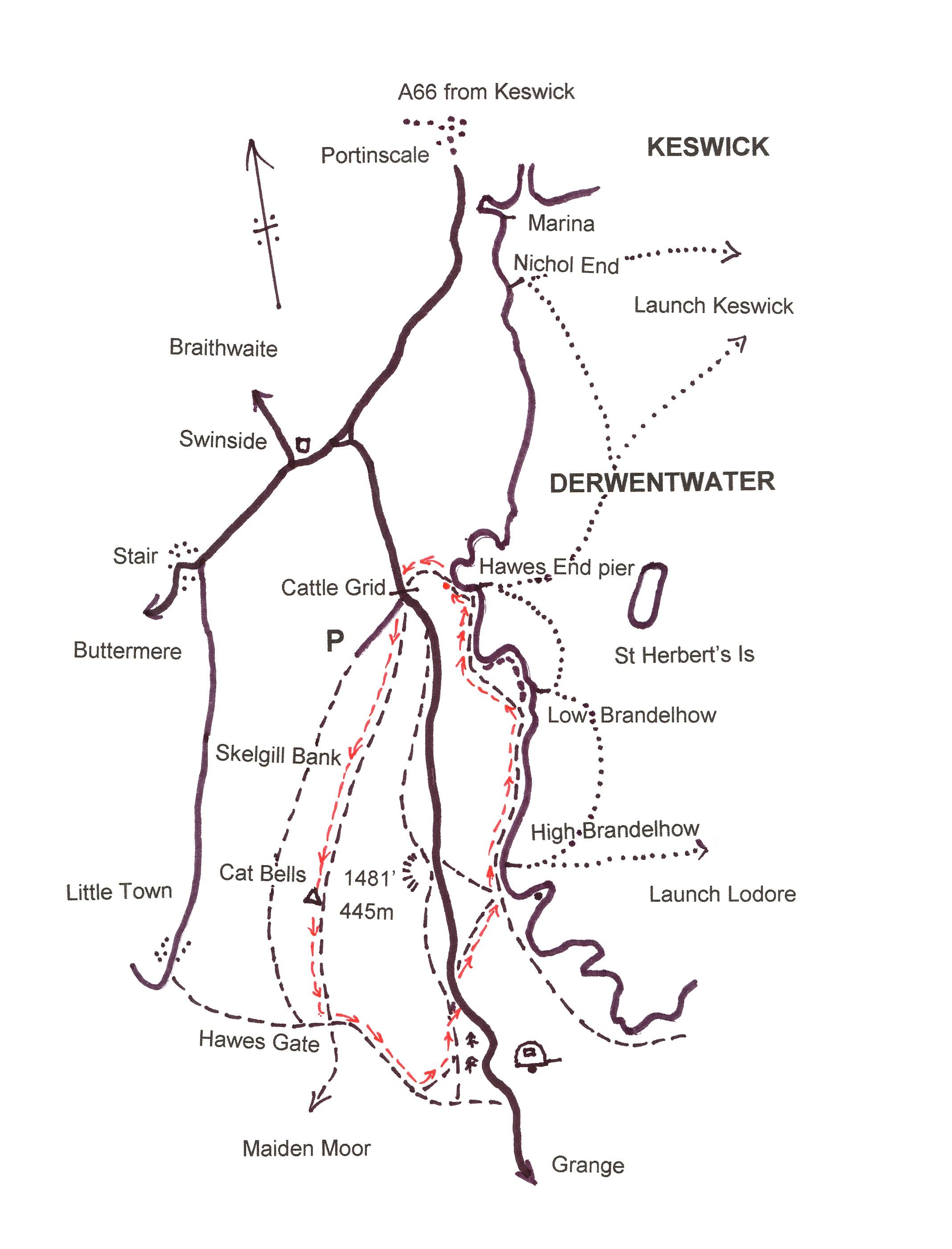
Catbells Walking Route


Download pdf Catbells Walking route
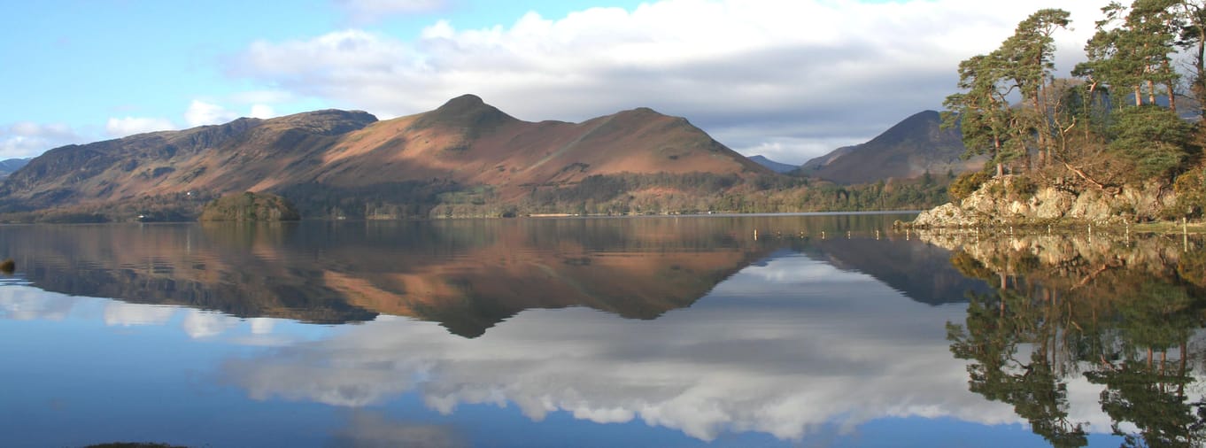
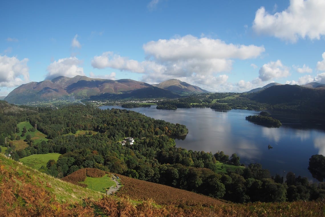
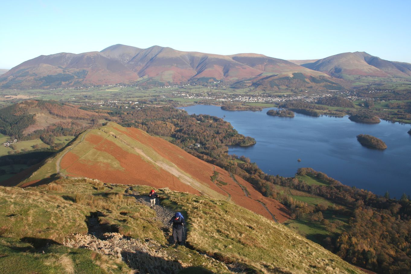
From the moment you step on the fell you can start to enjoy sensational panoramic views over Keswick, Derwent Water and Borrowdale. Add to this to the West the views of
- Distance - Approx 3.5 miles/5.7 kms
- Time - 3 hours approx plus stops
- Difficulty - Moderate. A short steep section on ascent with some minor scrambling.
- Starting point - This walk starts at Hawes End Landing Stage which can be best reached by taking the Launch from Keswick.
Park and Sail at Keswick Rugby Club
Park at Keswick Rugby Club, Crow Park Road where you will find 200 parking spaces. Park for the day and receive a Keswick Launch discount voucher. The voucher when presented at the Launch ticket office gives a 15% discount off the launch services that day for the driver and up to a maximum of 4 of their passengers.
Bus to Catbells
From Easter to October the Honister Rambler is a circular route from Keswick. The 77A from Keswick stops at Catbells before taking in Borrowdale, Honister, Buttermere and Whinlatter. To return to Keswick you would want to take the 77 which does the route in reverse. View the timetable and fares on our Getting Around Keswick page.
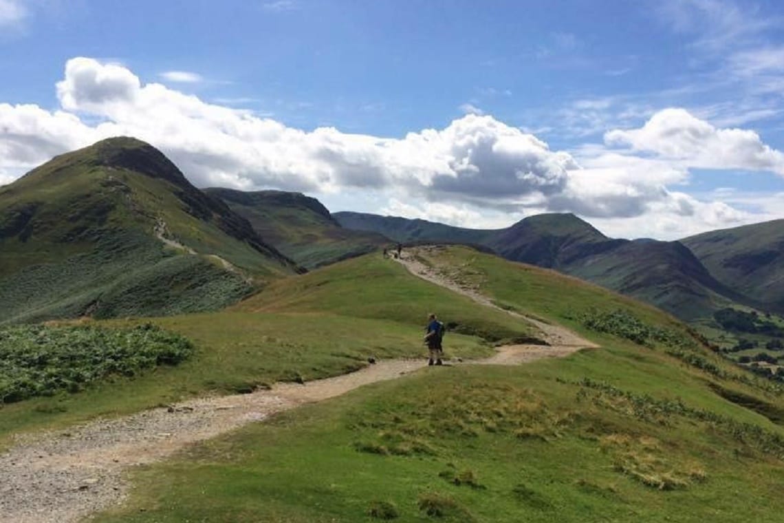
1.Follow the path up to the road away from the lake shore. From the cattle grid walk up the road 50 metres. The clear path leaves the road at the first bend and zig-zags steeply up the main breast of Skelgill Bank. The path levels for a short while and then climbs again to the summit of Cat Bells. There are some scrambly sections but nothing too technical.
2. Take a well deserved rest and obligatory photo stop at the top before descending south to the saddle of Hawes Gate.
3. From Hawes Gate, at the point where four paths meet, descend the steep but made up path to your left (East). Follow the path down and then take the path left towards a plantation of conifers. Here you join the main terrace path but your direction is downwards following a dry stone wall to the road. Follow the road left for approximately 50 metres and then turn right down to the lakeshore at
4.
Download pdf - Catbells walking route
Have you found this walking route useful and would like to make a donation? All our walks are provided free of charge to download but you might consider donating a small one-off amount to help with the running costs and upgrades to our website. This website is run by Keswick Tourism Association, a not for profit trade organisation, which is funded almost totally by its members.