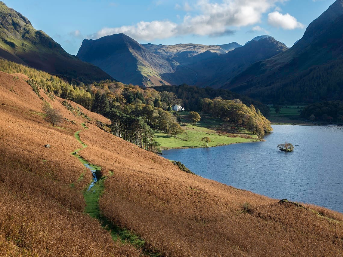
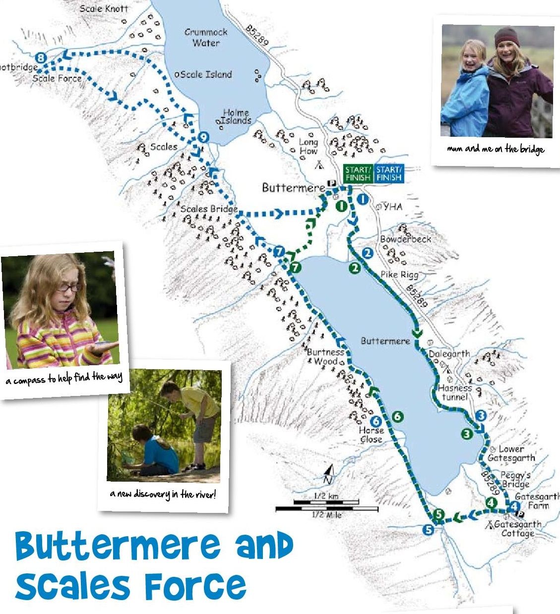
Buttermere and Scale Force
A lovely walk around Buttermere with the option to extend the route to the highest waterfall in the Lake District - Scale Force. The footpaths around Buttermere follow the lake shore closely and although there are a few ups and downs none are over strenuous. Scale Force, the highest waterfall in the Lake District has three distinct falls and is impressive even in dry periods.
Green Route (Short)
Start/Finish Buttermere (GR NY 175 169)
Distance 4.3 miles (7km) Time 2-3 hours
Height gain 154m
Terrain Lake side paths and bridleways, short tunnel,woodland, becks and gravel beaches
Maps OS Landranger 89, OS Explorer OL 4,Harveys’ Superwalker (1:25 000) Lakeland West,British Mountain Maps Lake District (1:40 000)
1 From the centre of Buttermere village walk 50m along the road (B5289) towards Honister Pass (southeast) to the start of a bridleway on the right. Follow this to the lakeshore path.
2 Once at the lake turn left and follow the path all the way around the lakeshore, through the tunnel at Hassness to rejoin the road (B5289).
3 Turn right and follow the road to Gatesgarth Farm.
4 Join the bridleway at the entrance to the farm and follow it across the valley bottom to Peggy’s Bridge.
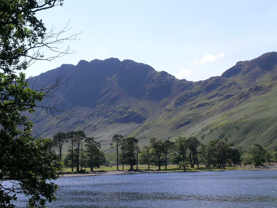
5 Cross the bridge and turn right at the junction to join the Burtness Wood bridleway. Follow this alongside Buttermere until it splits at Horse Close just before the trees. Take the right branch by the lake and through the trees. There are lots of little bays which make ideal picnic stops in Burtness Woods.
6 The footpath rejoins the bridleway at the end of Buttermere by a footbridge. The dashing waters of Sourmilk Gill which flow out of Bleaberry Tarn high in the mountains above also joins Buttermere Dubs at this point. After heavy rain this dashing gill forms a raging torrent and turns into white froth.
7 Turn right, off the Burtness Woods bridleway, and cross the footbridge. The bridleway on the other side is followed back to Buttermere village.
Blue Route (Long)
Start/Finish Buttermere (GR NY 175 169)
Distance 7.5 miles (12km) Time 4-5 hours
Height gain 360m
Terrain Lake side paths and bridleways, short tunnel, woodland, becks, gravel beaches, open fell and a remote waterfall
Maps OS Landranger 89, OS Explorer OL 4, Harveys’ Superwalker (1:25 000) Lakeland West,British Mountain Maps Lake District (1:40 000)
1 Follow the green route, directions 1 - 6, until you reach the footbridge at the end of Buttermere.
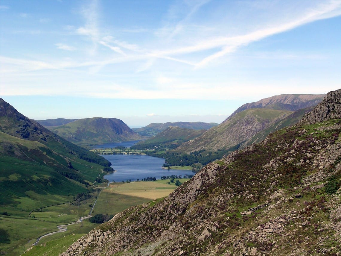
2 Ignore the footbridge and continue along the bridleway beside Buttermere Dubs and then alongside Crummock Water. Opposite Scales Island the bridleway leaves Crummock Water and turns west to climb towards Scales Beck. It then turns southwest and climbs more steeply to the foot of Scales Force.
3 There is a footbridge below the force, admire the impressive cascade, then take a higher level path leading back down across the fell in an easterly direction to rejoin the bridleway beside Crummock Water.
4 Once on the bridleway, retrace your steps as far as Scales Bridge. Turn left and cross the bridge following the bridleway on the other side back into Buttermere village to finish the walk.
Have you found this walking route useful and would like to make a donation? All our walks are provided free of charge to download but you might consider donating a small one-off amount to help with the running costs and upgrades to our website. This website is run by Keswick Tourism Association, a not for profit trade organisation, which is funded almost totally by its members.