A Highlight on the Smaller Wainwright Fells in the North Lakes
There are some fabulous Lower Level Wainwright Fells in the North Lakes.
They are a great way to start your Wainwright journey or you just fancy a cracking hike, with beautiful views that won't take all day.
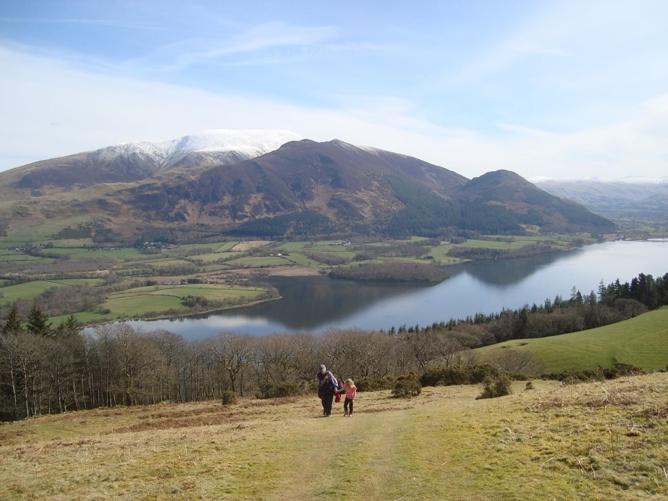
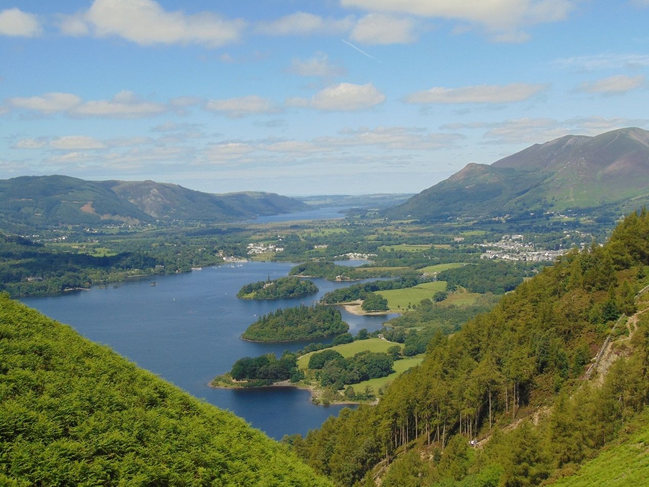
Latrigg - 368m
Latrigg is Keswick's very own fell and is a must do if you are staying in the area. The views from the summit over Keswick town, Derwentwater and the surrounding fells are breath-taking.
An easy up and down route via Spooney Green Lane from Keswick with a circular route round the summit.
If you can't make it all the way up from Keswick there is a small car park at Gale Road above Applethwaite with a Limited Mobility Path to the viewpoint
- Starting point - Moot Hall, Keswick
- Distance - 3 miles
- Time - 2 to 2.5 hours
1. Leave the Market Square between the Royal Oak & Greggs. Turn left into Station St. Go straight across the junction via the pedestrian crossing. Cross the bridge over the river Greta and immediately take the steps on your left down into Fitz Park.
2. Follow the path beside the river and take your first right. At the opposite corner of the park from which you entered follow the path uphill & past the BMX track. In 300m leave the path by a gate on your right and turn right into a metalled road.
3. After 200m turn left up Spooney Green Lane, a public bridleway signposted Skiddaw. The path takes you across the bridge over the A66. Go through a gate and continue up the same path ignoring turnings to your right.
4. The path rises more steeply now for 500 metres. This is the steepest part of the walk. The climb soon becomes less steep and the views open out to your left providing some good photo opportunities.Keep to the same path ignoring turnings to your right.
5. Cross 2 streams and go through a gate. Keep to the same path passing a tree plantation on your left with views over to the mighty Skiddaw. Ignore a path to your right signposted Latrigg summit 3/4 mile , this is the way you will come back down. For now keep straight ahead and follow the path as it zigzags up to the car park.
6. Go through the gate at the top of the car park and immediately turn right through a second gate signposted Limited Mobility Path Latrigg Viewpoint. As this path bends to the right fork left up the gravelly path which soon becomes grass. As you climb the mountains gradually start to be revealed until the breath-taking panorama of Derwentwater appears before you. Carry on straight up to the summit.
7. As you meet a path at the top turn right and follow the path down to a bench where a fantastic photo opportunity over Keswick, Derwentwater and the surrounding mountains awaits. Although a great vantage spot it is not always the best spot for a picnic as it can be quite windy. Follow the path downhill until you come to a fork and take the left one. (The right hand fork is the limited mobility path from the car park.) Follow the path as it zigzags its way down taking care as this part can often be muddy.
8. Turn left to re-join the path you ascended earlier past the tree plantation. Retrace your steps keeping to the same path you came up all the way back down to the road. Turn right and then left back into Fitz Park. Cross the park as you did earlier back to Keswick Town Centre
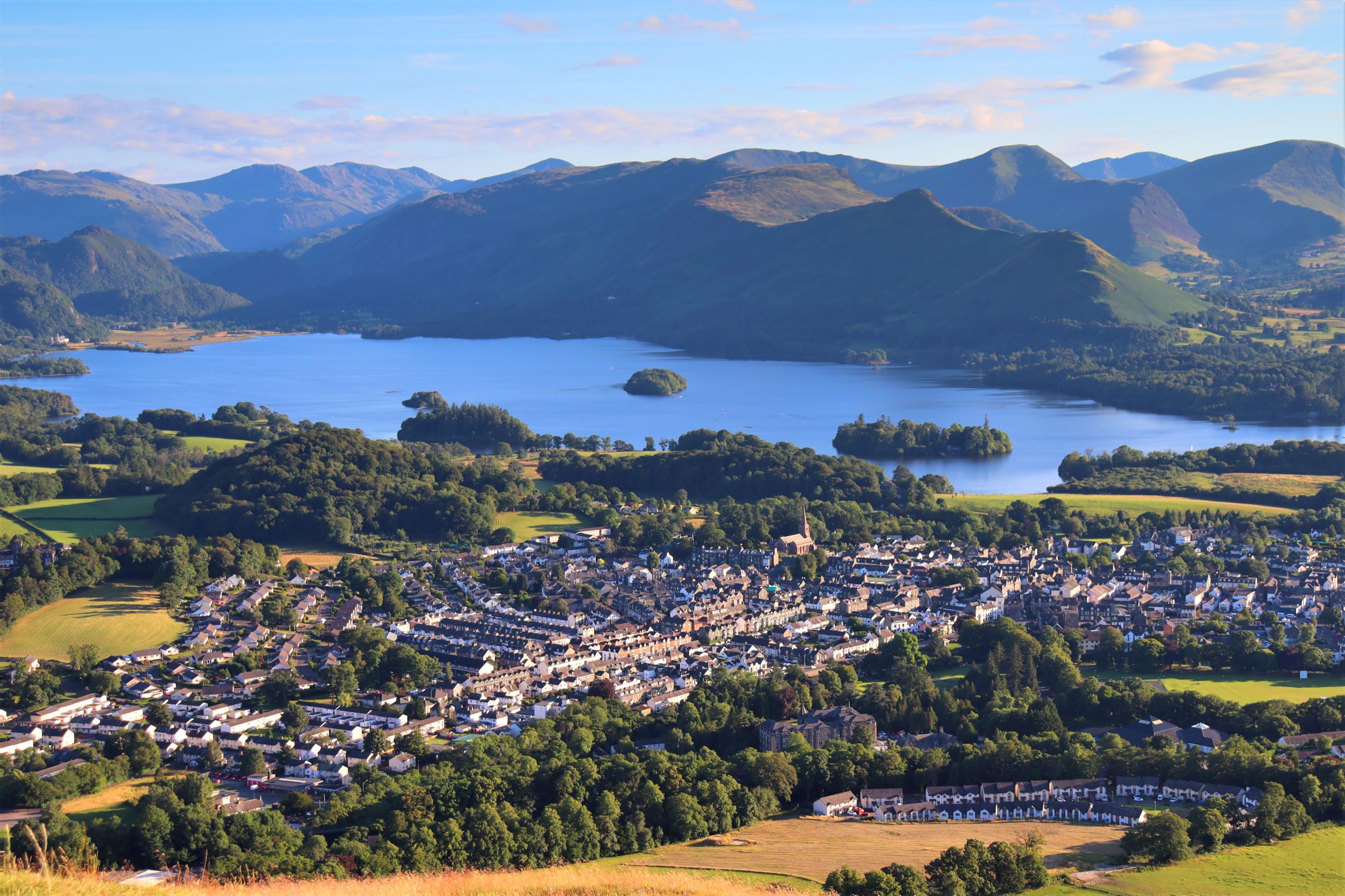
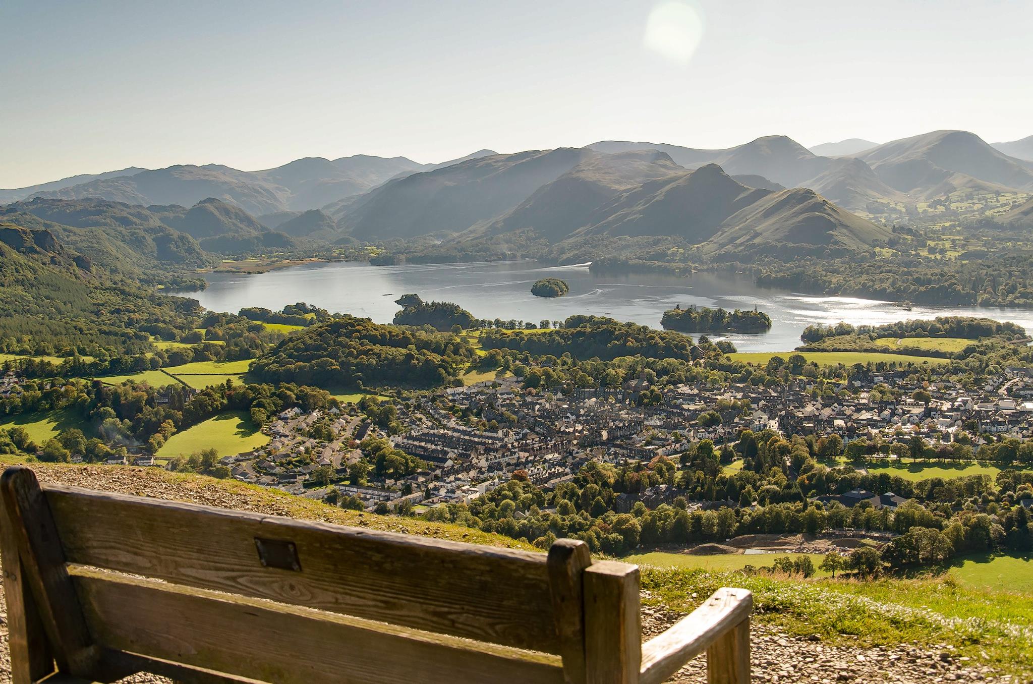
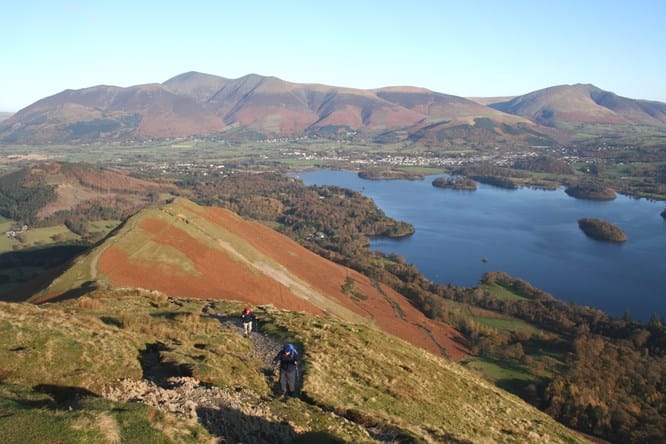
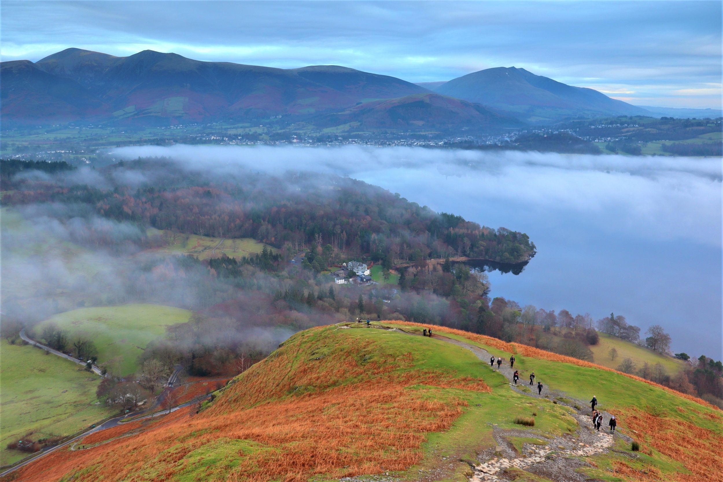
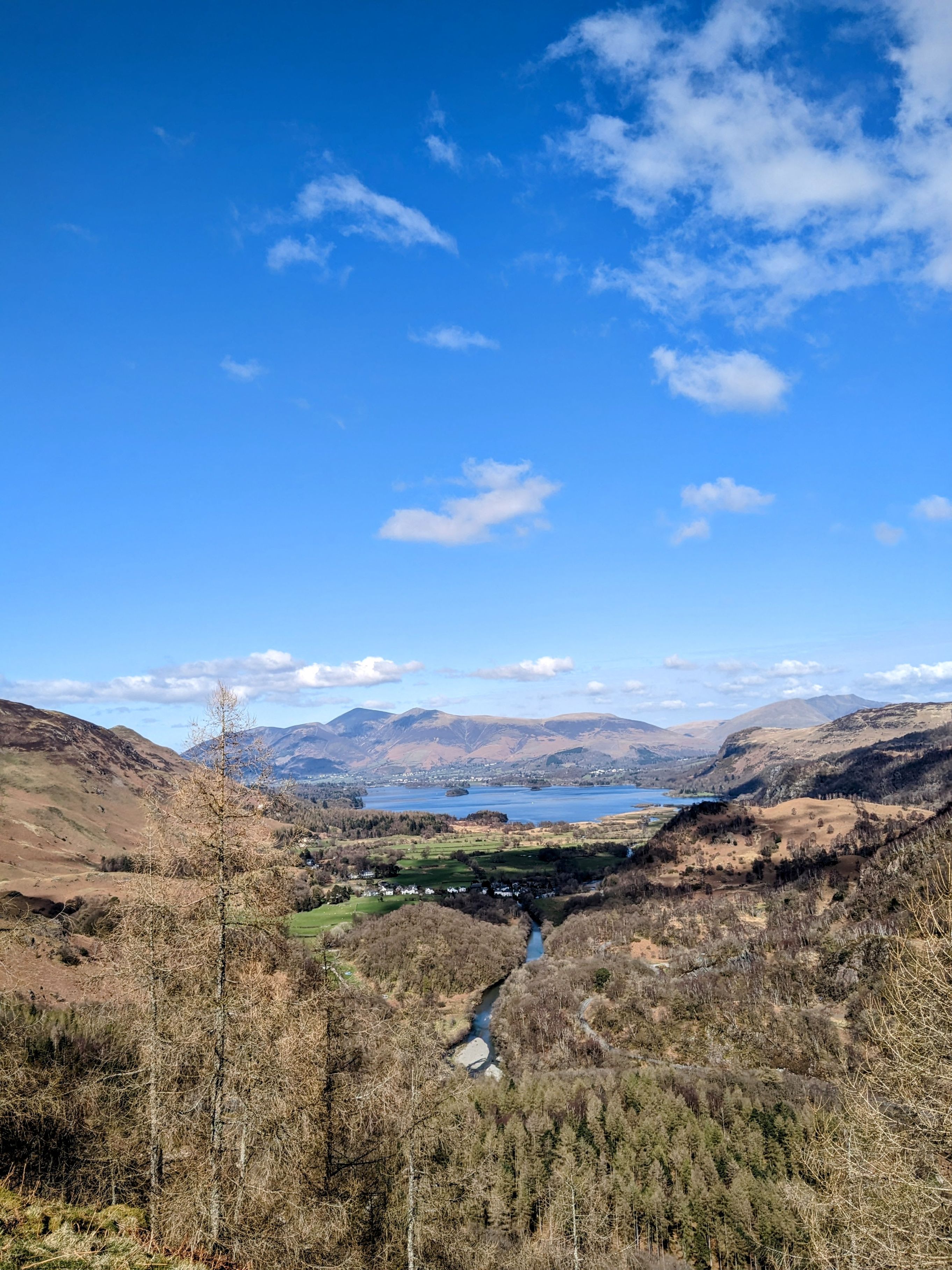
Walla Crag - 379m
This small Wainwright Fell sure is a beauty
- Distance - 6 miles
- Time - 3-4 hours
- Starting point - Market Square Keswick
1 Start from the Moot Hall in Market Square & head between Gregg's Bakery and The Royal Oak at Keswick into St John's Street. Pass the George Hotel on your left and shortly after pass St John's Church on your right. The road curves to the left. Just before the road starts to go uphill turn right into Springs Road.
2. Follow the road as it bends first left and then right until it ends at Springs Farm. Go through the gate and up into Springs Wood. Walk up through the wood with the stream on your left. Shortly the path splits in two, take the right-hand path. The path bends to the left and as it continues upwards the views over Derwentwater to the fells beyond open up as you climb giving you the opportunity to catch your breath and take a photo. The path continues past a mobile mast.
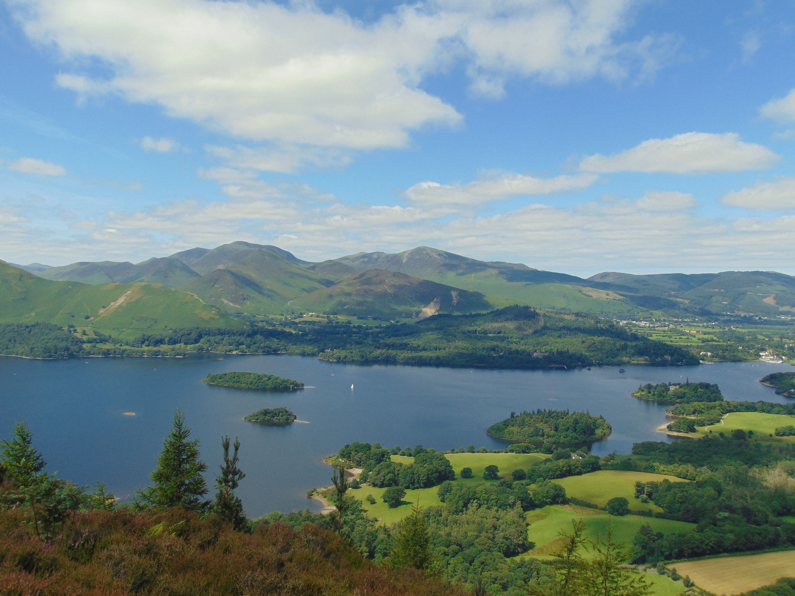
3. Go through a kissing gate and continue through a wooded section to a wooden bridge over the steam. Cross the bridge and continue up to a gate. Turn right onto a lane and shortly at a fork take the right hand one sign posted Walla Crag. Cross the stream over a wooden bridge and follow the path uphill signposted Walla Crag 1 mile. The path soon goes through a gate and continue upwards. After a short but steep climb take time to enjoy the views over Keswick, the Skiddaw range, Derwentwater and Bassenthwaite Lake.
4. The path drops down to where there is often a boggy patch and then rises to meet a wall next to a cairn. Here you have a choice of routes, you can go through a kissing gate on your right which takes you to the summit via a rocky path close to the edge of the crag with fine views over Derwentwater. Alternatively for the less agile or with younger children continue forwards up the grassy path beside the wall. The path goes down and back up again, again it can be quite boggy in the dip. At the top of the next rise, a stile on your right takes you past a cairn to the summit of Walla Crag.
5. After enjoying the summit views head down to a stile which leads over to a short rocky section. At a cairn take the left hand of two paths and then keep right at a fork in the route. Keep to the same rocky path downhill for just over a mile crossing streams as you descend. Go through a gate. Soon you will see another gate leading to a bridge. Don't go through this gate but turn right downhill signposted Ashness Bridge 150m. Go over a stile and bear left to Ashness Bridge, a much-photographed spot often to be spotted adorning tea towels and biscuit tins.
6. Proceed down the road. Part way down the road you can take a diversion to Derwentwater Youth Hostel via a fairly steep rocky path, a great place to stop for refreshments on the terrace overlooking Derwentwater. Otherwise, follow the road all the way down taking care as there is no pavement. Cross over the road at the bottom of the hill and go through a gap in the wall and down the steps to reach Ashness landing stage. You can take the Keswick Launch back at this point if you would like to shorten the walk.
7. To proceed, if the lake levels are low enough, you can walk along the lakeshore. The lakeshore path can be quite scrambly when lake levels are high. Alternatively go back up the steps and follow the roadside pavement and rejoin the lakeshore path at a suitable place further along. A little further along the lakeshore the going becomes easier and the path takes you over a wooden bridge over a stream. The path rises to a bench and soon drops down again to Calfclose Bay.
8. Continue along the lakeshore path over a wooden bridge and past the Centenary Stone. The stone marks 100 years of the National Trust taking care of places like Derwentwater. The path rises into woodland where a small diversion to your left the Millenium Seat makes a lovely place to stop and look out over the lake.
9. Continue along the shoreline path presently going through a gate. The path now heads between a wire fence and grassy area soon passing some houses and then curving left to go over a cattle grid. In approximately 500m turn left through a gateway signposted Keswick 1 1/4 miles. Keep forward to reach first a wooden boardwalk and then a bridge and gate which brings you back to the lakeshore. Keep to the path closest to the lake.
10. Go through a gate after which you can make a short diversion up steps to
Catbells - 451m
- Distance - Approx 3.5 miles/5.7 kms
- Time - 3 hours approx plus stops
- Difficulty - Moderate. A short steep section on ascent with some minor scrambling.
- Starting point - This walk starts at Hawes End Landing Stage which can be best reached by taking the Launch from Keswick.
Parking for Catbells can be tricky and it is really important to park sensibly and not block the narrow roads in the area.
Park and Sail at Keswick Rugby Club
Park at Keswick Rugby Club, Crow Park Road where you will find 200 parking spaces. Park for the day and receive a Keswick Launch discount voucher. The voucher when presented at the Launch ticket office gives a 15% discount off the launch services that day for the driver and up to a maximum of 4 of their passengers.
Bus to Catbells
From Easter to October the Honister Rambler is a circular route from Keswick. The 77A from Keswick stops at Catbells before taking in Borrowdale, Honister, Buttermere and Whinlatter. To return to Keswick you would want to take the 77 which does the route in reverse. View the timetable and fares on our Getting Around Keswickpage
The Route
1.Follow the path up to the road away from the lake shore. From the cattle grid walk up the road 50 metres. The clear path leaves the road at the first bend and zig-zags steeply up the main breast of Skelgill Bank. The path levels for a short while and then climbs again to the summit of Cat Bells. There are some scrambly sections but nothing too technical.
2. Take a well deserved rest and obligatory photo stop at the top before descending south to the saddle of Hawes Gate.
3. From Hawes Gate, at the point where four paths meet, descend the steep but made up path to your left (East). Follow the path down and then take the path left towards a plantation of conifers. Here you join the main terrace path but your direction is downwards following a dry stone wall to the road. Follow the road left for approximately 50 metres and then turn right down to the lakeshore at
4. Now follow the lakeshore path through the wooded shore line, passing High Brandelhow Landing stage and then Low Brandelhow, eventually returning to the start point at Hawse End.
High Rigg - 357m
A lesser known Wainwright but this is an absolute beauty and a lot quieter than most other fells.
It is an undulating ridge walk there are fine views of the Helvellyn and Skiddaw ranges and into the valleys of Thirlmere and St John's in the Vale with a return route back through the valley.
- Distance - 5.2 miles
- Time - 2.5 to 3 hours
- Starting point - United Utilities Legburthwaite Car Park St John's in the Vale GR NY318195 CA12 4TQ
- Enter via the B5322 road off the A591 at St John's in the Vale between Keswick and Grasmere
- There are toilets in the car park, though these may be closed in winter
- Public Transport - 555 bus to Legburthwaite on the A591 The bus stop is close to the ladder stile in section 1 of the route.
- Notes - Good footwear is essential as can be boggy. Care is needed with younger children as some steep drops on the final section of the walk
The Route
1. Leave the car park via a small gate at the opposite end from which you drove in. Turn left onto a walled lane. Turn right onto the A591 and walk along the grass verge for 250m and then turn right over a ladder stile or through a gate.
2. Take the left-hand path heading uphill. The path soon splits again, take the left-hand path continuing uphill. Follow the path as it undulates upwards with Thirlmere soon coming into view behind you with Raven Crag looming above it. Pause to look at the view behind you with increasingly larger glimpses of Thirlmere as you ascend. As you reach the first summit of the day, Wren Crag, the views now open up over St John’s in the Vale towards Blencathra.
3. The path now descends, goes between a wall before climbing more steeply up a narrow stony path. The path levels out, drops a little, then gently undulates with views down into the valley below. Follow the path up and down and then go over a stile and turn right to walk beside the fence. High Rigg Tarn soon comes into view. There’s a path to either side, head round it whichever way seems the driest as it is prone to being boggy.
4. The path now drops to a ladder stile over a wall. The path continues up alongside the wall. As the path splits keep to the path alongside the wall to the right of Moss Crag. Drop down and turn left away from the wall skirting round the end of the crag, then turn right upwards towards the next summit.
There is some confusion over which parts of the fell are the true summit of High Rigg. This is the Wainwright summit but according to the OS map the summit is at the high point of 357m further along the ridge.
Keep forward on the grassy path. As you meet another path turn left. Soon the path drops down before steadily climbing to the summit as marked by a cairn.
5. Drop down off the craggy top to join the path heading downwards. In the distance is Tewett Tarn though our route today doesn’t take us that far. Beyond is the Skiddaw range with Latrigg beneath it. As the path splits continue steeply downwards heading (the stepped foot-holes making the descent a little easier) to a white building. The path goes through a gate in the wall and then to the left of the Carlisle Diocesan Youth Centre.
6. On reaching the road turn right, shortly passing the tiny St John’s church. Visitors are welcome to go in. Just past the churchyard turn right through a gate signposted Sosgill Bridge. Continue along the path, after some time going through a gate then keep forward. The path continues, goes through a gate and over a stile. Keep following the path and go through another gate. The path then skirts above Low Bridge End Farm.
7. After the farm the route heads along the beck before starting to climb. Take care especially with young children on this stretch due to steep drops below the path. Soon the path heads away from the river and then brings you back to the main road. Turn left and left again back to the car park.
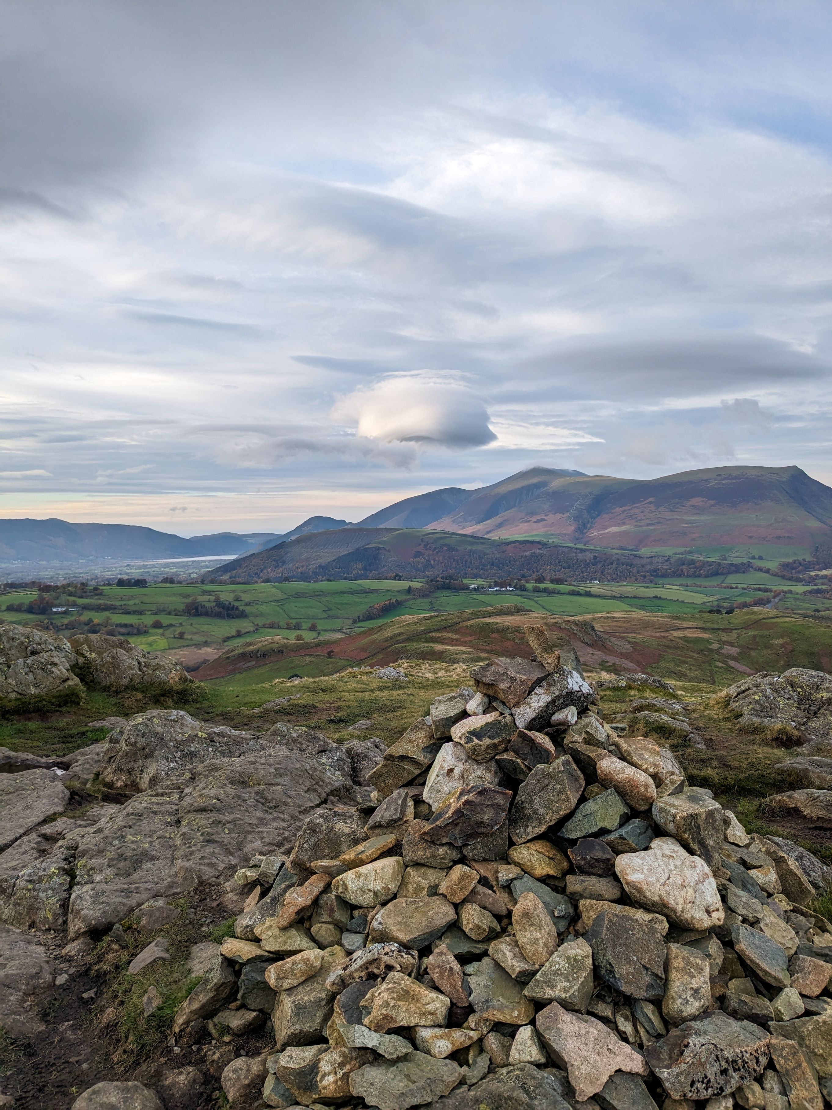
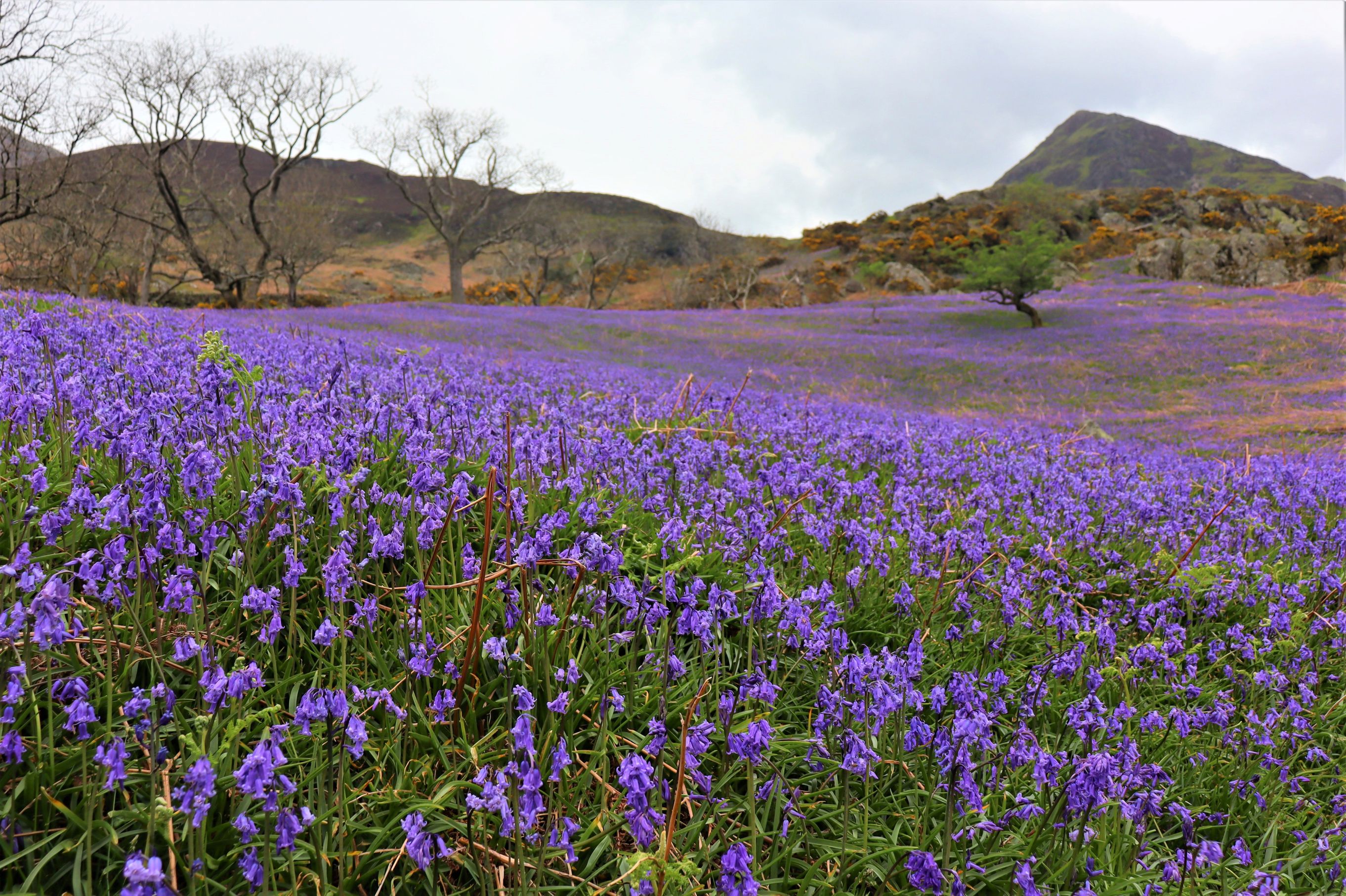
Rannerdale Knotts - 355m
- Distance - 4.5 miles
- Time - 2.5 - 3 hours
- Starting point - 2 roadside car parks at Cinderdale Common on the B5289 between Lorton and Buttermere. If these are both full there is also a small parking area at Buttermere Hause GR NY163184— if you park at the latter follow the walk instructions from no.3
A beautiful walk up into the Rannerdale Valley, round the base and then up the fairly short but quite steep Rannerdale Knotts, along the ridge with lovely views towards Buttermere and back down the valley.
The Route
1. From the Cinderdale Common car park walk 100m up the Cinderdale Beck to the path just above you and turn right. Ford the stream and follow the path up the valley. In early to mid May the Rannerdale Valley turns blue with a beautiful carpet of bluebells.
2. Cross a bridge over Squat Beck and turn right to go down the left hand bank of the stream. Continue on this path beneath the crags of Rannerdale Knott until you come to the small parking area at Buttermere Hause.
3. Go through the car park and turn left onto the road which runs beside the shores of Crummock Water. Almost immediately take an uphill path on your left which is rocky at first becoming grassy. As you ascend ignore two faint grassy paths to your left and keep upwards on the same path. You will come to a junction of paths from which point you can see the Lake of Buttermere. At this point take the path take the path to your left. After a grassy start the path climbs steeply via a steep rocky staircase. The path becomes grassy again. Pause to catch your breath. You can now see Loweswater beyond Crummock Water. The path turns to the right in front of a pair of rocky outcrops and winds its way up fairly steeply. The path bends to the right, a little scrambly in places over rocks.
4. At the summit an excellent vantage point awaits from which you can see Crummock Water, the Solway Firth and if it is clear across to Scotland. From the summit follow the path past the cairns and along the long undulating rocky ridge with views to Buttermere village and lake.
5. As you near the end of the ridge you will come to a junction of 5 paths. Take the path left to join the valley below. As you meet the path turn left and follow it down the Rannerdale Valley. Cross the bridge you came over at the start of the walk and retrace your steps back down the valley to the car park.
Castle Crag - 290m
This may be the smallest Wainwright but don't be fooled as it is a steep one, but it is all worth it for absolutely stunning views.
This route follows the terrace path above the lovely Borrowdale Valley. A short diversion takes you up to Castle Crag via a short but fairly steep zigzag path of loose slate. The route drops through the Jaws of Borrowdale down to the River Derwent below and follows the riverside path back to the hamlet of Seatoller.
- Distance - 5 miles
- Time - 3 hours
- Starting point - National Trust Car Park Seatoller (NT members free)
- By public transport - Bus 78 from Keswick to Seatoller, click here for timetable
The Route
1.Leave the car park by the main entrance and turn right up the road through Seatoller village. Just after the houses, opposite a turning area turn right through a gate. Follow the path to a second gate & continue upwards. The path curves to go through a further 2 gates and up a stony track. Pass a steeper track coming up from Seatoller on your left. Ahead there is a choice of 3 paths. Take the middle one up to a small gate in the corner of the wall. Through the gate turn right and follow the path adjacent to a wall.
2. Soon Castle Crag comes into view ahead. Keep forward over a bridge and through a gate. Keep to the same track with Castle Crag in your sights ahead. As you reach a crossroads of paths keep forward to a gate and over a double bridge and then cross the stones over another stream. As you come to a T-junction turn right. Derwentwater soon comes into view ahead.
3. Just as the path starts to drop take a path on your right hand side up Castle Crag. Follow the clear path upwards, after some time going over a stile and a ladder stile . Follow the zig-zag path up the slate and up to the summit where you can enjoy views over Borrowdale and Derwentwater.
4.To leave the summit retrace your steps but instead of going back over the ladder stile follow the path down to the right and then turning right to re-join the path you left earlier. Follow the stony path downhill. As you meet a junction of 3 paths take the right one over a small wooden bridge. At the river turn right signposted Rosthwaite. Through the gate a bench awaits with views over the river or you can drop down the path to a lovely stopping place on the river bank. To continue the path heads up along the side of a wall. Turn left through a gap in the wall. Take the next path to the left signposted Rosthwaite. Continue along this path presently coming a walk along the riverside.
5. Go through a gate and continue along the riverside path. Go over a wooden bridge, keeping to the right of the river. Continue along the riverside path signposted Longthwaite. Turn right onto a metalled road to pass in front of Borrowdale Youth Hostel. The path becomes rocky and in places there are metal chains to help you cross the boulders. Shortly past the base of the cliff you are back on a stony path.
6. The path continues through a wall and comes to a gate. Turn left and continue to another gate on the left taking you back to Seatoller car park.
Sale Fell - 359m
Sale Fell is one of the lesser-known fells and is situated in a quiet area above Wythop some 8 miles from Keswick. It is most certainly an area to put on your list to explore and return to again and again. There are numerous paths around the fell and surrounding woods, so there are plenty of beautiful walks to choose from.
- Distance - 3.8 miles
- Time - 2 hours
- Starting point - Roadside parking St Margaret’s Church Wythop Mill NY 190301
The Route
1. Go through a gate 100m east of the church onto a footpath which rises diagonally up the hill. Very soon you will come to a bench above Wythop St Margaret's Church with views over Bassenthwaite Lake. Continue up the grassy path until you come to a T-junction. Take the right hand path.
2. Just before the path starts to descend turn left up the hill. When the path splits keep to the right hand side and continue upwards to the summit.
3. From the summit continue forwards downhill. Just before a gate in the wall turn right and follow a path alongside the wall. Continue downhill past a farm
4. As the path meets the farm lane turn left, then in 50m turn right (signposted Beck Wythop) past a bench. Go through a gate and continue forwards on a grassy path past the ruins of Kelswick church. Go through a tall gate and into Chapel Wood.
5. When the path splits keep to the top left path. The path leaves the wood and rises to another large gate. Follow the path upwards, soon Bassenthwaite Lake comes into view to your right.
6. Fifty metres before a gate turn left steeply up a grassy path. When the path forks take the right hand one. The path soon curves left past an area of felled trees. The path gradually drops down. Take care crossing a stream - in wet periods the surrounding area can be very boggy. Turn right and go through a gate.
7.Follow the path downhill. Bassenthwaite Lake soon comes into view again on your right. Keep down until you come back to the bench from the start of the walk. Turn right here and follow the path down hill through the gate back to the start